 |
| MINE ACQUISITION : |
 |
|
|
| |
| Geology, Resources and Exploration Services |
You explore to create wealth. You need the most effective methods to find the best opportunities and make choices. With state-of-the-art targeting tools, we can minimise your risks, cut your costs and reduce your time frames. Our independent assessments and advice provide the basis for your choices.
Our experts integrate complex data sets to generate and refine targets, define controls on ore bodies, and delineate prospective structures and sequences.
We effectively map open pits and underground mines to improve grade control, ore reserve modelling, mine plans and near mine drill targeting.
Our clients turn to us for review, audits and independent assessment of their projects.
We also offer practical courses and workshops for geologists in mineral exploration and mining. You select the modules most appropriate for your staff, your geological environment and your exploration objectives, with examples chosen for practical field study on your property.
|
| 3D Geological Modelling |
Aditya Coal geologists combine their skills in structural and geological interpretation of ore deposits with the application of new innovative modeling packages to construct, dynamic, 3D geological models. This creates a unique synergy between the interpretation of geological data and model construction, which is focused on testing and evaluating applied solutions in the exploration and mining process.
Our tools include Leapfrog, gOcad, MapInfo, ER Mapper, ArcGIS and FracSIS in conjunction with conventional packages such as Gemcom, DataMine and Surpac. Aditya Coal's applied modeling workflow enables the integration of multiple 3D and 2D datasets, and the real-time, rapid evaluation of exploration targets (district to deposit-scale) assessing controls on ore distribution, evaluating ground stability and controls on hydrogeology. This allows the rapid and seamless incorporation of results into resource and reserve estimation, mine planning and exploration targeting.
The success of Aditya Coal's 3D modeling approach empowers our clients. The controlled evaluation of disparate datasets within a single 3D environment unlocks the true value potential of our client's data.
- Compilation of historical exploration and mining datasets into a 3D environment
- Integration of 2D and 3D GIS datasets
- Terrane scale modeling and 3D exploration targeting
- Evaluation of geological controls on ore distribution in 3D
- Resource modeling, using defined geological criteria and not by grade alone
- Country rock domain modelling, defining geotechnical and hydrogeological domains
|
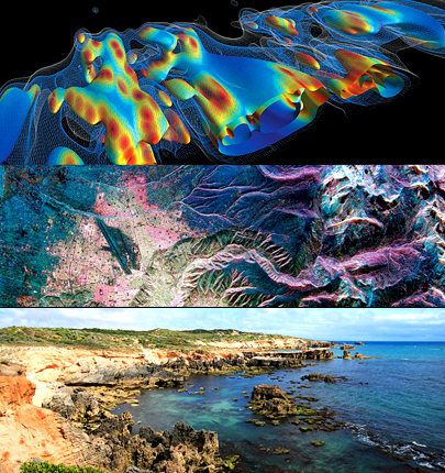
| Remote Sensing and Geophysics |
Target delineation driven by the geological processes hidden in remote sensing data
Approach
We have a unique combination of Specialist Structural and Alteration Geologists, Geophysical Processing Experts, and Seismic Interpreters. Aditya Coal’s multi-skilled geophysical and geological team ensures the full value is unlocked from remote sensing data.
The structural geologists in Aditya Coal’s team have knowledge of mineralization controls on a wide range of deposit types. The skills applied to our interpretations are derived from mapping experience within Archean, Proterozoic, and island arc terranes. Aditya Coal’s products are unique in that they identify geological processes, rather than just lines on a map. Aditya Coal's value discriminates the geological features relevant to your exploration strategy.
Services
- Advanced aeromagnetic interpretations to produce structural/geological maps showing the relative timing of structural events
- Ranking of exploration targets for specific deposit styles or commodities
- Interpretation of 2D and 3D seismic data, and integration with aeromagnetic interpretations to produce 3D models of basement architecture
- Satellite imagery interpretation for mapping of regional structures, regolith and alteration
- Combined processing and analysis of Landsat and aeromagnetic datasets
- Production of interactive GIS products that can be developed over time by the client
- Regional basin analysis to identify pathways for ore-forming fluids
- ‘Tailor-made’, on-site geophysical interpretation training courses with a focus on empowering exploration geologists with the knowledge required for the geological interpretation of geophysical data
|
| Resource Modelling and Estimation |
Unlocking greater value with experience and innovation
Our geologists have extensive experience in exploration, database management, resource estimation, grade control and conditional simulation. We can take your project from grassroots exploration through the feasibility study stage and into production.
Our approach to resource estimation combines our strengths in structural geology and ore deposit geology, our understanding of geostatistical theory and our extensive resource estimation and mining operational experience. While each resource estimate is tailored to each specific project, our general procedures typically include:
- An assessment of the quantity and quality of the data available including database management and verification
- The creation of 2D and/or 3D geological and mineralisation models for the deposit
- Statistical and geostatistical analyses of the data and the determination of the most appropriate grade and density interpolation methods
- Classification and reporting according to accepted internationally recognised guidelines
We have a large skill base and extensive experience in the use of all the major geological modelling and geostatistical packages. Notably, the original Gemcom software was developed within Aditya Coal while more recently the Leapfrog software has been developed under a joint venture agreement with Applied Research Associates of New Zealand. This gives Aditya Coal the flexibility to continue the use of the software that you are currently using or select the most appropriate software on new projects.
We have experience in developing and reviewing geological models and resource estimates for all commodities and deposit types. We also have a large base of competent/qualified persons as defined by the various internationally accepted resource reporting codes.
- Evaluations of exploration properties
- Reviews of exploration sampling results and QAQC procedures
- Optimisation of drillhole targeting for resource definition
- Exploration and database management
- Creation of 2D and 3D geological, structural and mineralisation models
- Statistical and geostatistical analyses
- Resource estimation, classification and reporting for all stages of projects from scoping studies though to feasibility Studies and operating mines
- Due diligence reviews of geological interpretations and resource estimates
- Metal accounting and production reconciliations
|
| Mining Exploration Project Management |
Successful exploration relies on efficient project management based on effective application and interpretation of geology, geochemistry and geophysics to generate and test exploration targets. Our core exploration management services deliver on testing targets, from grassroots to resource definition drilling projects. We also provide economic assessments and project evaluations.
- Project planning, permitting and implementation
- Drilling contracting and contract management
- Core and cuttings logging
- Geotechnical and water logging and monitoring
- QA/QC design and implementation
- Assay contracting and management
- Statutory and JORC reporting
|
| Exploration Project Initiation |
Whether you are planning to explore a new area, or thinking about buying an existing exploration property, Aditya Coal can assist in the decision-making process. Using our extensive worldwide, multi-commodity expertise, we can generate regional geological syntheses, and collate and review historic data to provide the vital information you need to make informed choices. We can assist you to locate the relevant project area information, and digitally capture and integrate audited datasets in a fully interactive 3D or 2D spatial environment.
Aditya Coal provides and implements QA/QC designs so that you can identify any shortcomings of existing data and work with validated datasets. Careful design of data acquisition and handling procedures allows you to fully capitalise on all opportunities within your tenement.
- Regional geological reviews
- Regional exploration targeting
- Review and validation of historic data, including validation of resources
- Due diligence and valuation
- Data validation and migration into spatial database environments (2D/3D)
- Development and implementation of QA/QC methodologies
|
| Geological Mapping and Analysis of Drill Hole Data |
Geological mapping is fundamental to any exploration project. Effective exploration requires an in-depth understanding of the lithological and structural controls of mineralisation. These insights must be gained through geological mapping at the early stages of the exploration program.
Mapping is a cost-effective exploration tool and a project-generative process that delivers tangible benefits to all exploration programs. A good geological map not only provides focus to an exploration program, it also clearly communicates the economic potential of a project to stakeholders.
At Aditya Coal, our people have experience in mapping and the utilisation of drilling information in a variety of commodities and geological settings. Using our knowledge of regional to mine-scale mapping, interpretation of bottom-of-hole geology and coherent interpretation of drilling programs, we can generate high-quality products in a time-efficient manner. Our multi-disciplinary team ensures that the most appropriate datasets, including geophysics, are utilised to generate robust interpretations. Our consultants have access to a variety of software packages and can ensure the data and interpretations generated can be included in subsequent work programs.
- Base mapping
- Drill core logging
- Structural mapping to define geometry and mineralisation controls at regional to mine scales
- Regolith mapping to support regional geochemical programs
- Alteration mapping to define controls on mineralisation
- Interpretation of multiple datasets in an inetegrated 3D environment
- Expert analytical support to solve specific issues (eg. petrography, alteration, age-dating, fluid inclusions)
|
| Exploration Targeting |
Aditya Coal’s specialised exploration services are built on our core strengths. These include advanced structural interpretation skills, the ability to connect the minerals systems to the structural setting, systematic orebody targeting and 3D modelling. We specialise in the development of process-driven, conceptual models to identify and improve the understanding of your mineral targets. Our in-house consultants have expert knowledge of the mechanisms of orebody formation and distribution within a wide range of geological and tectonic settings.
Delivering exploration success in the growing area of deep targeting requires a much more reliable understanding of the geometry of structures in the third dimension. This need is driving development of 3D modelling and 3D visualisation technologies (for example, GoCAD, Geomodeller and Leapfrog software, ensuring that mineralisation targets are defined by more than one or two simple exploration or mining parameters, and is directly focused on adding value to the project.
These new technologies are essential tools for effective 3D exploration. We use cutting-edge 3D geological and geophysical modelling methods, in conjunction with more traditional technologies, to give us a distinct advantage in providing better solutions for our clients.
- Structural and alteration analysis
- Mineral system analysis
- GIS-based fuzzy logic (expert-driven) targeting
- Weights of evidence (data-driven) targeting
- 3D geological modelling
- Orebody modelling
|
| Basin Studies |
Basin Evolution
The evolution of sedimentary basins is largely controlled by a response in the crust to tectonically driven forces. The way in which the crust responds to those forces is controlled by the strength, composition and fabric of the crust at the time of the tectonic event. Knowing the properties of the basement of a sedimentary basin allows prediction of the behaviour of the basin during deformation.
It is the basement that responds to the tectonic stress by extending or contracting. Sedimentation patterns then respond to the resulting changes in the basement.
SEEBASETM
Potential field data (principally gravity and magnetic data) provide a window to the basement that can cover a wide continuous area. Once calibrated to geology, these data provide information that allows the development of a predictive structural model based on basement composition and structure. Depth to magnetic basement can be modelled from magnetic data and used to produca a structurally-controlled model of basement topography (e.g. SEEBASETM). Once calibrated, basement structure and topography can be used to predict basement-involved and basement-detached structures, fluid migration pathways, source distribution, reservoir and seal quality and distributions throughout the basin. The interpretation techniques and tools are efficient and cost-effective at both the country and permit or concession scale.
Integrated Modelling
The methodology used to develop a comprehensive structural model relies on the integration of all appropriate geophysical and geological information. Individual datasets alone can be ambiguous and when interpreted in isolation often produce poorly constrained results. Integration is achieved by calibration of each dataset with others. Through integration, the model can be tightly constrained.
Once the datasets have been calibrated, a model consistent with all available data can be developed. Then the model can be applied and tested by re-calibrating and checking against the seismic interpretation. Adjustments can bemade as needed to both the model and the seismic interpretation at this stage.
Cost-Effective Exploration
Aditya Coal has had considerable success using a range of non-seismic tools to reconstruct basin architecture and map petroleum systems:
- Difficult areas where volcanic/intrusive and/or salt bodies are present;
- In frontier areas where sparse 2D seismic is available;
- In mature exploration areas where adequate non-seismic data is available in addition to dense 2D and 3D datasets.
The systematic calibration, integration and interpretation of non-seismic and seismic data, working from the basement up is an efficient and effective approach in all areas. The methods are ideal for quickly developing a knowledge platform for designing cost-effective exploration and acquisition strategies in both high-risk frontier areas and more mature areas where existing concepts and dogmas may be a barrier to further exploration.
|
| Exploration Sampling and Analysis |
The collection of reliable samples from a mineral prospect or mine is an essential basis for the production of an accurate resource estimate. The strategy to be adopted must thus be carefully designed so that at each stage of the process, the chance of taking biased, unrepresentative or contaminated samples is minimised.
Aditya Coal has the capability to assess a client's existing sampling programs in order to determine whether the strategy employed by the client is meeting set aims and objectives. We consider key factors in executing these evaluations, such as, whether the correct sample volume is being taken, whether a change could be introduced which would have significant impact and be cost effective and whether the drillhole or sample layout will provide the level of confidence sought for the subsequent resource estimate.
Expertise
Aditya Coal has the expertise to design, manage and audit sample collection and preparation procedures on behalf of clients in both the mineral exploration and mining industries. This expertise has been developed over 25 years during the supervision and auditing of drilling programmes undertaken as part of exploration projects and mine feasibility studies and also during the performance monitoring of operating mines. In addition, sampling programmes have been designed for base line environmental geochemical studies and for the assessment of contaminated mine sites.
Our technical staff have the necessary statistical/geostatistical expertise and computer software to undertake in depth studies of the assay information obtained from sampling campaigns and to produce detailed conclusions and recommendations.
Services
Sampling and sample preparation protocols should be designed to produce the highest possible data quality given the nature of the target mineralisation and the ground conditions. Issues addressed in such protocols include the following:
- Optimum sample length, volume or weight and compositing strategy in relation to the physical characteristics of the mineralisation
- Optimum sampling methodology and collection procedure to minimise contamination, avoid loss of fines in the case of rotary percussion drilling, and to produce representative unbiased samples
- The establishment of on-site supervision and checking procedures for drilling and sampling programs
- Monitoring of sample recovery
- Sample homogenisation and splitting procedures
- Duplicate sampling at each stage in the reduction and splitting process to determine the magnitude of errors at each stage
- Quality control procedures to monitor sample preparation and analysis at the mine or commercial laboratory
- Replicate sampling and analysis to determine precision of sample grades
- Comparative studies between assay laboratories and determination of accuracy
- Compatibility of assay databases produced by different sampling campaigns
|
| Exploration QAQC |
Appropriate Sampling and Quality Assurance /Quality Control (QA/QC) is essential in all aspects of the mineral deposit evaluation process to ensure the best possible confidence in resultant mineral resource and reserve estimates are achieved; the quality of an estimate is dependent on the quality of the data used.
Approach
Aditya Coal has experienced personnel who can audit, review and advise on quality control procedures, in addition to performing data reviews during all project phases.
When reviewing QA/QC data, we typically consider two defined areas: review of the QA/QC procedures in place, and review of the QA/QC database.
Our experienced consultants review existing sampling protocols and advise on the appropriate sampling strategy taking into account both theoretical and practical implications of sampling techniques.
Using a combination of analytical techniques and drawing upon their broad experience of best practice, Aditya Coal 's experts are capable of drawing pertinent conclusions and making recommendations to clients to ensure compliance with international reporting codes.
We understand the importance of a managed QA/QC program for all projects, ensuring data quality which forms the basis for all resource estimates.
Experience
Our resource consultants have extensive experience in reviewing QA/QC data from all project stages, and have experience setting site and regional sampling protocols and associated QA/QC programs. We have undertaken a number of projects managing electronic data capture, validation and management of QA/QC databases to ensure compliance with international reporting codes.
- Independent reviewing and practical advice on sampling protocols to ensure compliance with international reporting codes
- Recommendations on QA/QC procedures from sampling through to assay and data management
- Independent review of QA/QC procedures and databases to ensure compliance with international reporting codes
- Chain of custody and, verification drilling programs
- Review of sample preparation and laboratory facilities
|
| Structural Geology |
Many ore deposits are formed within tectonically active areas, such as ancient basins and orogenic belts. It is no wonder then that the vast majority of mineral deposits are affected or controlled, to a greater or lesser extent, by geological structures.
From the perspective of mineral exploration and mining, the potential influence of both large- and small-scale structures on projects cannot be understated, with structures impacting most technical issues, including: grade control, resource estimation, targeting, rock mass engineering and hydrogeology.
Approach
Regardless of the structural issue, Aditya Coal’s initial approach is unwavering: understand the problem, understand the economic implications, and focus on the fundamental issues.
Depending upon the nature of the commission, the study may combine: a brief review of salient data and reports, definition of key issues, focussed data collection (outcrop and drillcore), 3D geometrical and kinematic analysis using state-of-the-art software, and the integration of findings, resulting in a robust structural model.
Experience
Aditya Coal’s structural geologists have a broad experience of the contrasting technical issues where structural geology impinges during the various stages of exploration and production.
Using their experience coupled with their understanding of geological processes, Aditya Coal’s structural experts have recently assisted in the identification of ore deposit controls for near-mine and regional exploration targeting; the characterisation and analysis of fractures to help mitigate mine stability and water in-flow problems in underground environments; 3D modelling of structurally complex deposits to assist with resource wireframing; and the definition of structural geometries in geotechnical studies of large open pit operations.
- Determination of structural controls on mineralisation for use in near-mine and regional exploration programs
- 3D geometrical modelling of complex ore bodies for mineral estimation
- Integration and interpretation of geological, geochemical and geophysical data
- Characterisation of fracture systems for geotechnical and hydrogeological studies
- On-site training in structural geology, tailored to the client's project site
- Practical advice on the acquisition of pertinent structural data
|
| Powered By : http://www.calcuttayellowpages.com |
|
|